GeoSelect cuts chemical use, costs, spray time and record keeping.
Stategic Decisions
Pre-scanned data gives you the edge, you know how much chemical to mix, which rows to skip and where to slow down to get the best efficacy from your chemical application. All this before you even get in the drivers seat.
No Excessive Equipment
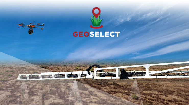
With multiple, light-weight GNSS antennas mounted along the boom, precision accuracy can be maintained and real-time data collected. The use of pre-programmed geolocation data means cameras aren't required - so additional costs and strain on the boom with excessive equipment is completely avoided.
Low Light and Full Speed Spraying Compatibililty
Accuracy of application is retained even at standard speeds of 25 to 30kmph, as well as at night. GeoSelect automatically adjusts for boom deflection and changes in ambient conditions, making it robust and accurate in any environment.
Be across all aspects of the spraying process with GeoSelect's cutting edge user interface.
GeoSelect Advantages
GeoSelect provides farmers with real-time information and suggestions on spraying practices, such as the optimum speed to drive at in certain parts of the paddock to achieve maximum efficiency and savings, or skipping certain run lines altogether due to absence of weeds in a particular area.
Australian Designed and Manufactured
GeoSelect was fully designed in Australia, for the unique Australian conditions encountered . This means large paddock sizes, temperature extremes, dust ingression etc.
Accountability
A comprehensive spray record is recorded, allowing the operator to show proof of placement.
Savings
Less chemical on ground
Less chemical use means less chance of spray drift
Right amount of spray volume means overall machinery weight will be lower, reducing compaction
Less machinery fuel used means less carbon emitted, scope for when carbon pricing is introduced into the future
Economical
Reduced chemical costs
Less machinery fuel costs because you are not driving it as far and also using the speed more efficiently. Also knowing how much spray volume is needed means you are only carrying the amount needed, further saving fuel costs on road and in paddock
Using the machinery less will reduce depreciation costs and allow a higher resale value into the future
Reduced labour times means less salary costs
Trials conducted by HARDI showed the selective program resulted in only 17.4 per cent of a paddock being sprayed, an 82.6pc saving on chemical compared to a blanket spray.
Time
Less time needed to spray paddock compared to blanket spray
Time saved when skipping AB lines where there are no weeds present
Speed recommendations given prior to the specific areas allow the operator to speed up in light or no weed areas, and slow down in heavier areas
Precision
With the advent of on-boom positioning, including boom wings, positioning of spray application and timing is second to none. Something that is very important when targeting small areas with a wide boom width.
As the sprayer is working with the same resolution as the paddock was captured in, spray application can be targeted
Efficiency
Know what is in the paddock before you get there. Decisions can be made prior to starting work, saving countless time.
Weed infestation areas can be identified and recommendations can be made as to what speed is optimal, saving time traversing spare weed areas. Something that is not possible using cameras.
Knowledge
Weed maps and spray records are best in class, and can be compared year on year. Imagine being able to go spraying later in the Summer spray season, and see what weeds were present in the last 1 or 2 sprays. See what weeds are persisting/resistant, and what is newly emerged.
A comprehensive spatial database can be made throughout the use of GeoSelect. Decisions might be made for other activities using the data gained by GeoSelect.
GeoSelect produces a detailed map with weed locations and presents it to farmers before they even head into the paddock, which allows them to plan ahead. Farmers are able to make informed decision about how much chemical to mix, which areas to skip, and when to speed up or slow down.
Would you like to be one of the first to hear when we are launching a new sprayer, revealing new features or releasing a new video? Sign up to our monthly newsletter and get your HARDI news first!